Catalog Archive
Auction 108, Lot 166
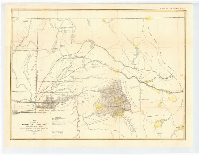
"Map of a Part of Washington Territory East of Cascade Mtns. Showing Topography of the Mines Region &c. to accompany the Report of E. Giddings", U.S. State Surveys
Subject: United States - Northwestern
Period: 1862 (dated)
Publication: HR Doc #1, 37th Cong. 3rd Sess.
Color: Hand Color
Size:
23 x 17.2 inches
58.4 x 43.7 cm
Download High Resolution Image
(or just click on image to launch the Zoom viewer)
(or just click on image to launch the Zoom viewer)