Catalog Archive
Auction 108, Lot 165

"The Territories of Washington and Oregon", Colton, Joseph Hutchins

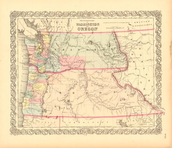
Subject: United States - Northwestern

Period: 1856 (published)

Publication: Atlas of the World

Color: Hand Color

Size:
16 x 12.7 inches
40.6 x 32.3 cm
Download High Resolution Image
(or just click on image to launch the Zoom viewer)

A great map of the Pacific Northwest showing both territories extending to the Continental Divide and that region that would become Idaho. Of specific interest is the notation of all the major exploration routes, wagon trails and the proposed routes for the transcontinental railway as explored by Gov. Stevens. The organized counties of both Oregon and Washington are confined to a narrow band along the coast. Decorative border. Includes the descriptive text page with fascinating information on the territories.

References:

Condition: A

Some stains in blank margins, well away from map.

Estimate: $250 - $325

Sold for: $190

Closed on 9/29/2004

Archived