Catalog Archive
Auction 108, Lot 155

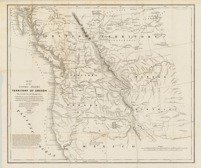
"Map of the United States Territory of Oregon West of the Rocky Mountains…", Abert/Hood

Subject: United States - Western

Period: 1838 (dated)

Publication: Report of the Senate select committee on the occupation of the Oregon Country

Color: Black & White

Size:
20.5 x 17.5 inches
52.1 x 44.5 cm
Download High Resolution Image
(or just click on image to launch the Zoom viewer)

This map accompanied an important report intended to awaken public interest in the American occupation of Oregon Territory in the controversy with Great Britain, who also claimed the territory down to the Columbia River. Among the many interesting details are the locations of the various trading posts or forts connected with the northwestern fur trade, both American and British. The map covers present day Oregon, Washington, Idaho, Montana, and Wyoming. The region west of the Rocky Mountains is named Mandan District. It also shows much of southwestern Canada. A very historically important map.

References: Claussen & Friis #221; Hayes #197; Wheat (TMW) #434.

Condition: B

Folding, as issued. A few areas of light foxing and a closed tear at binding side into border, still a remarkably clean and bright example of this map.

Estimate: $600 - $800

Sold for: $650

Closed on 9/29/2004

Archived