Catalog Archive
Auction 108, Lot 144

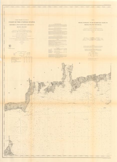
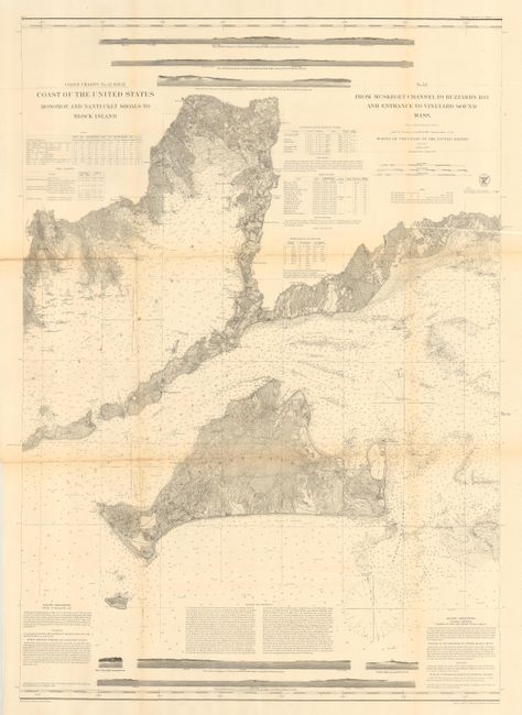
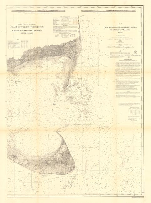
"[Lot of 3 - Nantucket and Martha's Vineyard]", U.S. Coast Survey

Subject: United States - Northeast

Period: 1874 (published)

Publication:

Color: Black & White

Size:
28.5 x 37.5 inches
72.4 x 95.3 cm
Download High Resolution Image
(or just click on image to launch the Zoom viewer)

This matched set of charts provides a detailed examination of the Northeast Atlantic in the vicinity of Nantucket and Martha's Vineyard. Filled with sailing directions, dangers in the area, and information on tides, winds, currents, etc. Chart No. 12 has profile views of Nobska Light and Cuttyhunk Light. Size given is approximate for each chart. Set includes: No. 11 - From Monomoy and Nantucket Shoals To Muskeget Channel Mass; No. 12 - From Muskeget Channel to Buzzard's Bay and Entrance to Vineyard Sound Mass.; No. 13 - From Entrance to Buzzard's Bay Mass. To Block Island South RI.

References:

Condition: B

Issued folding, now backed with archival tissue. All very good except for some toning along folds.

Estimate: $450 - $500

Sold for: $475

Closed on 9/29/2004

Archived