Catalog Archive
Auction 108, Lot 135

"A Map Shewing the Communication of the Lakes and the Rivers between Lake Superior and Slave Lake in North America", Anon.

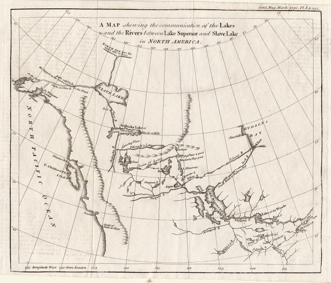
Subject: Canada and Alaska

Period: 1790 (published)

Publication: Gentleman's Magazine

Color: Black & White

Size:
9.2 x 8.7 inches
23.4 x 22.1 cm
Download High Resolution Image
(or just click on image to launch the Zoom viewer)

Intriguing map based on the map and report of Peter Pond in 1787. The map traces the route from Lake Superior to Lake Winnipeg and then through an interconnected chain of lakes and rivers to Arabaska Lake and Slave Lake. The most interesting feature is the speculative river flowing out of Slave Lake, over "falls said to be the largest in the known world," and emptying into Cook Inlet. Published in the March 1790 issue.

References: Hays, #130; Jolly GENT-283; Kershaw #1159; Wheat [TMW] #222.

Condition: B

Clean, bright example with crisp impression. Trace of offsetting in blank areas, else very good.

Estimate: $220 - $275

Sold for: $275

Closed on 9/29/2004

Archived