Catalog Archive
Auction 108, Lot 126

"Plan de la Ville de Quebec", Bellin, Jacques Nicolas
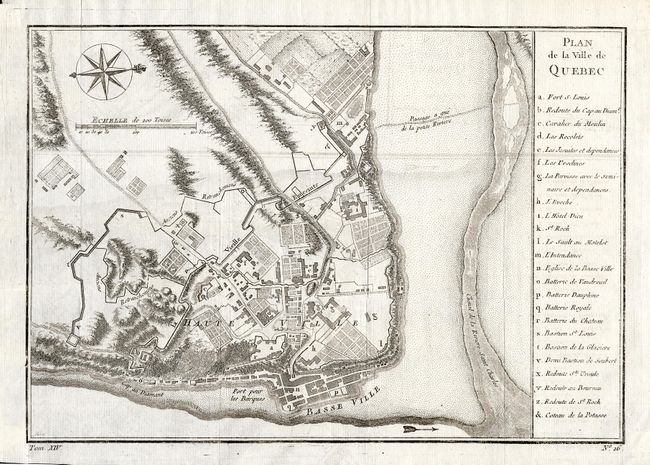
Subject: Canada

Period: 1757 (circa)

Publication: Prevost's Historie Generale des Voyages

Color: Black & White

Size:
11 x 7.6 inches
27.9 x 19.3 cm
Download High Resolution Image
(or just click on image to launch the Zoom viewer)

Attractive map of the city of Quebec showing the city's fortifications with a key at right identifying the major buildings, etc. Bellin's plan (first issued in 1744) was the definitive plan of the city for most of the eighteenth century. Finely engraved with a compass rose.

References: Kershaw #1054.

Condition: A

Remnant of hinge tape on verso with a small hole in blank margin, well away from map.

Estimate: $240 - $300

Sold for: $190

Closed on 9/29/2004

Archived