Catalog Archive
Auction 108, Lot 102

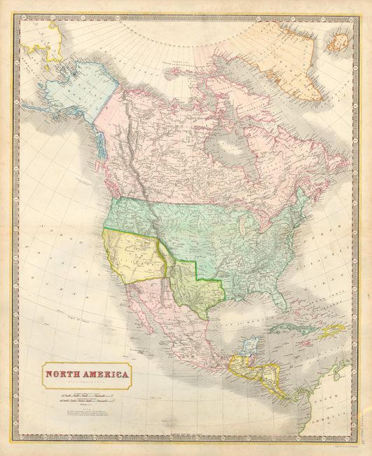
"North America", Johnston, Alexander K.

Subject: North America

Period: 1845 (circa)

Publication: National Atlas

Color: Hand Color

Size:
19.7 x 24 inches
50 x 61 cm
Download High Resolution Image
(or just click on image to launch the Zoom viewer)

Beautifully colored and remarkably detailed map filled with interesting geography. The independent Republic of Texas is shown with its border extending well north. Upper California occupies the entire southwest and present day California. The U.S./Canadian border is correctly located with a notation that both Britain and the U.S. claim the entire region west of the Rockies and between the Mexican and Russian boundaries. Filled with place names, early railroads, forts, Indian villages, and much more. Piano-key borders and simple title cartouche.

References:

Condition: B

Fine impression and color on thick paper with full margins. A little scattered foxing in blank areas, else very good.

Estimate: $250 - $300

Sold for: $210

Closed on 9/29/2004

Archived