Catalog Archive
Auction 107, Lot 98

"A New Map of North America: shewing the Advantages obtain'd therein to England by the Peace", Anon.

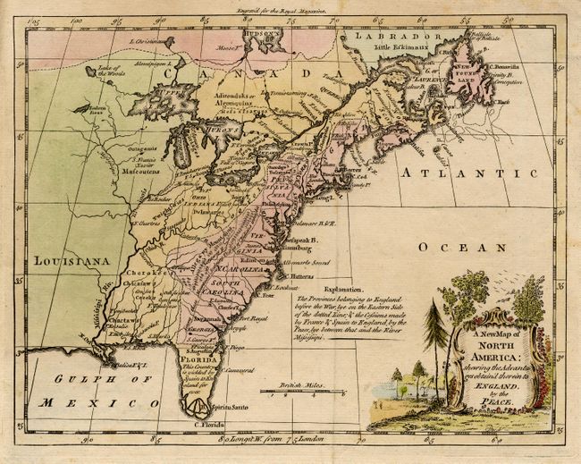
Subject: Colonial North America

Period: 1763 (published)

Publication: Royal Magazine

Color: Hand Color

Size:
9.5 x 7.4 inches
24.1 x 18.8 cm
Download High Resolution Image
(or just click on image to launch the Zoom viewer)

This very uncommon little map illustrates the results of the peace treaty following the French and Indian War. The map shows the British Colonies prior to the war, delineated by a dotted line and colored pink, confined to the eastern seaboard. The regions ceded to Britain by France and Spain are shown in yellow and extend from Florida to the Mississippi River and into Canada considerably beyond the Great Lakes and the St. Lawrence River. French Louisiana is colored green. The map includes the locations of Indian villages, forts and several interesting notations including, "Among these Mountains Scalping tribes of Indians inhabit." A landscape style title cartouche ornaments the map.

References: Jolly ROYMAG-24; Phillips (M) p.581.

Condition: A

Lovely original color. A little light spotting in borders, still very good.

Estimate: $400 - $450

Sold for: $300

Closed on 6/9/2004

Archived