Catalog Archive
Auction 107, Lot 505

"Africa ex magna orbis terre descriptione Gerardi Mercatoris desumpta", Mercator, Gerard (the younger)
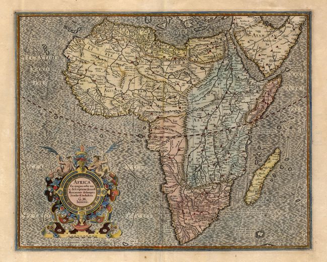
Subject: Africa

Period: 1613 (circa)

Publication:

Color: Hand Color

Size:
18.6 x 15 inches
47.2 x 38.1 cm
Download High Resolution Image
(or just click on image to launch the Zoom viewer)

Compiled from Gerard Mercator's world map of 1569, this map was drawn by Mercator's grandson (also named Gerard) in 1595, and published later by Hondius. The map is typical of 16th century cartography with considerable fantastic detail in the interior. The depiction of the Nile is based on Ptolemy's geography with some complex modifications from various sources, including Abyssinian monks. The source of the Nile is shown as a series of lakes located in the Lune montes just north of the Tropic of Capricorn. Another branch of the Nile flows from the west, with this system rambling through what is the Sahara Desert. In Abissini, Mercator shows Prester John sitting on his throne. The engraving, especially the boldly engraved oceans, beautiful calligraphy, and strapwork cartouche (surmounted by two satyrs) make this a decorative masterpiece. Latin text on verso.

References: Norwich #21.

Condition: B

Old repair and slight creasing at centerfold. Light coloring with a little bleed through on verso.

Estimate: $1,600 - $1,800

Unsold

Closed on 6/9/2004

Archived