Catalog Archive
Auction 107, Lot 491

"Tabula nova Indiae orientalis & meridionalis", Fries, Lorenz

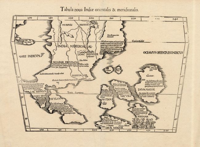
Subject: Southeast Asia

Period: 1541 (published)

Publication: Claudii Ptolemaei Alexandrini Geographicae

Color: Black & White

Size:
16 x 11 inches
40.6 x 27.9 cm
Download High Resolution Image
(or just click on image to launch the Zoom viewer)

This scarce map is a landmark in the cartography of Southeast Asia - the first printed map to focus on the region of Malaya, Indochina and the East Indies. It was based on Waldseemuller's large 1507 cordiform world map, which was in turn taken from the Martellus model with nomenclature derived principally from Marco Polo. The mythical Lake Chiang Mai, labeled Lamia Lacq, is located at the top border. The islands are placed in a barely recognizable fashion including Iava Maior in roughly the position of Borneo. A small vignette illustrating cannibalism is set in the island of Angama (Andaman Islands).

References: Nordenskiold, II #211-42; Suarez (SEA) Fig 62 pp.114-118.

Condition: A

Very fine impression. Two worm tracks in bottom margin, well away from map.

Estimate: $2,500 - $3,000

Sold for: $2,200

Closed on 6/9/2004

Archived