Catalog Archive
Auction 107, Lot 320

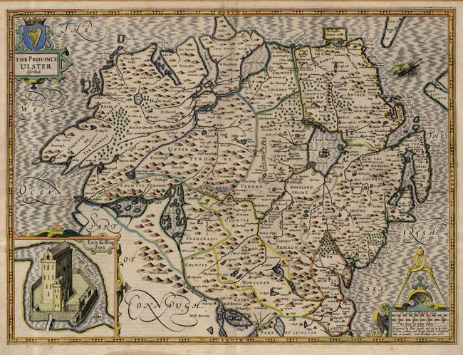
"The Province Ulster described", Speed, John

Subject: Ireland

Period: 1611 (circa)

Publication: Theatre of the Empire of Great Britaine

Color: Hand Color

Size:
21 x 16 inches
53.3 x 40.6 cm
Download High Resolution Image
(or just click on image to launch the Zoom viewer)

A fine, decorative map of the northern province of Ulster, present-day Northern Ireland. Speed's map reflects the 16th century political turmoil and military struggle between the English and Irish with several fortifications in County Tyrone, Armagh and Monaghan, built after the rebellion of 1593. The sturdy fortress of Enniskillen (Enis Kelling Fort) in County Fermanagh is inset and the map is embellished with a decorative title cartouche, a scale of miles with large calipers and fine lettering and ornamentation throughout. A sea monster patrols the fully stippled sea. From an early edition with the imprint of John Sudbury and George Humble. A desirable example of Speed's beautiful work, here on the higher quality and thicker paper.

References:

Condition: A

Dark impression and full original color with original margins and pleasant age toning. Extreme outer edge (1/8") of margin toned from earlier matboard, well away from image.

Estimate: $1,200 - $1,400

Sold for: $900

Closed on 6/9/2004

Archived