Catalog Archive
Auction 107, Lot 315

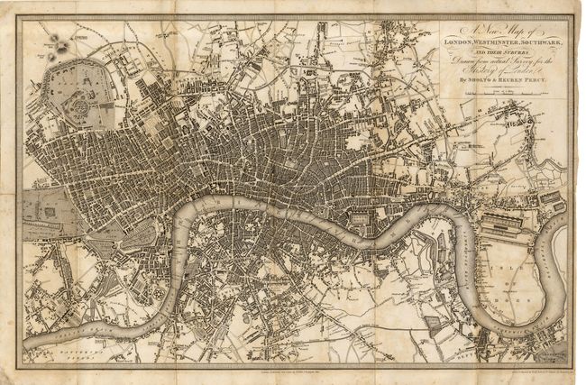
"A New Map of London, Westminster, Southwark, and Their Suburbs", Davies, Benjamin Rees

Subject: England

Period: 1823 (circa)

Publication: History of London

Color: Black & White

Size:
15.2 x 9.7 inches
38.6 x 24.6 cm
Download High Resolution Image
(or just click on image to launch the Zoom viewer)

An obscure but precisely engraved map of London from the 1823 publication "History of London" by Sholto and Reuben Percy. Fine detail throughout.

References:

Condition: C

Dark, crisp impression on thick paper. Toned along some folds with scattered foxing or offsetting. Tiny area of loss at some fold intersections and a well closed tear into border. The map shows better than the condition would indicate.

Estimate: $70 - $90

Sold for: $230

Closed on 6/9/2004

Archived