Catalog Archive
Auction 107, Lot 209

"Johnson's New Map of the State of Texas", Johnson & Ward
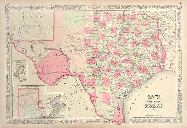
Subject: Texas

Period: 1864 (circa)

Publication:

Color: Hand Color

Size:
24.5 x 16.5 inches
62.2 x 41.9 cm
Download High Resolution Image
(or just click on image to launch the Zoom viewer)

Large, handsome map with county development mostly in Eastern Texas and only the three large western counties of El Paso, Presidio, and Bexar in the west. The panhandle, noted as the Staked Plains (Elevated Table Land, without Wood or Water), includes a large section that is unorganized. Nice depiction of the wagon roads, many named, with several completed railroads including the Houston & Guaymas R.R. Insets include a Plan of Sabine Lake, Plan of the Northern part of Texas, and Plan of Galveston Bay. Decorative scrollwork border.

References:

Condition: A

Small split on bottom fold, repaired with archival tape.

Estimate: $275 - $350

Sold for: $170

Closed on 6/9/2004

Archived