Catalog Archive
Auction 107, Lot 205

"Karte von Texas, entworfen nach den Vermessungen welche in den Acten der General Land Office der Republic liegen bis zum Jahre 1839", Anon.
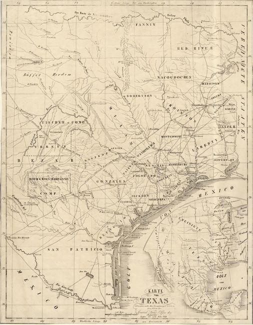
Subject: Texas

Period: 1841 (circa)

Publication:

Color: Black & White

Size:
12 x 15.5 inches
30.5 x 39.4 cm
Download High Resolution Image
(or just click on image to launch the Zoom viewer)

Rare German colonization map of the Republic of Texas derived from the larger Hunt/Randel map from surveys of the General Land Office of the Republic in 1839. The map was published in a pamphlet published by Prince Solms-Braunfels circa 1841. Prince Solms-Braunfels was head of the Society for German Emigration to Texas (Adelsverein). German immigrants formed a large segment of the republic's population in the 1830s and early 1840s, supposedly in a secret plot to establish a German state in North America. These immigrants were inspired by glowing reports in a number of German books and pamphlets describing a bountiful American frontier with political and personal freedom unknown in Europe. The map is carefully delineated to show the various colonies and locates forts, mines, settlements and roads. Of particular interest are the land grants with which the Adelsverein was involved: Bourgnois D'Orvanne et Comp and Fischer et Comp übernommen vom Verein. Inset in the Gulf of Mexico is a map of the region surrounding the republic designed to show the prospective immigrant the location of Texas in North America.

References:

Condition: B

Trimmed to, and occasionally into neat line else very good.

Estimate: $3,000 - $3,500

Unsold

Closed on 6/9/2004

Archived