Catalog Archive
Auction 107, Lot 182
"Geological Map of the Lake Superior Land District in the State of Michigan", U.S. Government
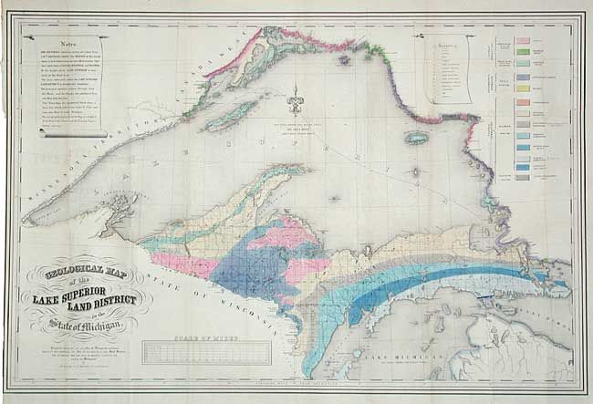
Subject: Michigan
Period: 1847 (circa)
Publication:
Color: Hand Color
Size:
39 x 25.7 inches
99.1 x 65.3 cm
Download High Resolution Image
(or just click on image to launch the Zoom viewer)
(or just click on image to launch the Zoom viewer)