Catalog Archive
Auction 107, Lot 110

"A New and Correct Chart of the Coast of New Foundland from Cape Raze to Cape Bonavista, With Chebucto Harbour in Nova Scotia Done from the latest Observations", Mount & Page
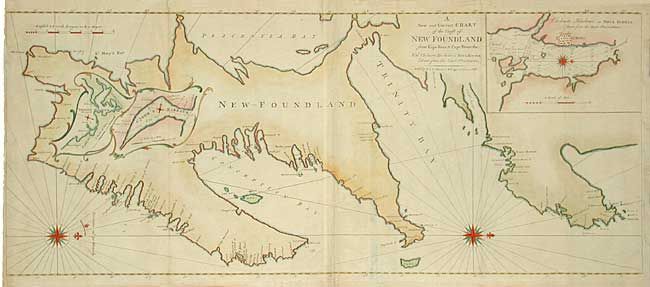
Subject: Canada

Period: 1755-75 (circa)

Publication: The English Pilot: The Fourth Book

Color: Hand Color

Size:
39.7 x 16.5 inches
100.8 x 41.9 cm
Download High Resolution Image
(or just click on image to launch the Zoom viewer)

Large, handsome chart of the Avalon Peninsula with an inset showing one of the earliest plans of Halifax. Two additional insets, with fancy rococo-style borders, detail Trinity Harbour and St. John's Harbour. Bold and well-engraved chart ornamented with three large compass roses orienting north to the right. Two sheets joined as issued.

References: Kershaw #523.

Condition: B

Minor binding damage at centerfold and at paper edges including a tiny loss of neatline, else very good.

Estimate: $500 - $600

Unsold

Closed on 6/9/2004

Archived