Catalog Archive
Auction 107, Lot 104

"Virginiae partis australis, et Floridae partis orientalis, interjacentiumq regionum Nova Descriptio", Jansson, Jan

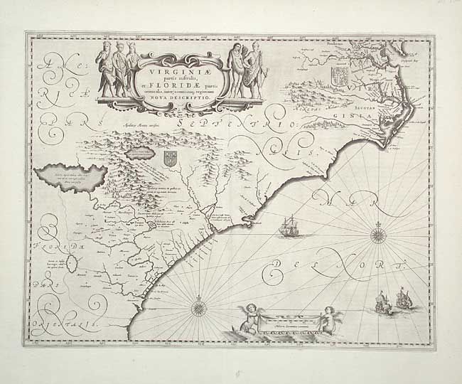
Subject: Colonial Southeast

Period: 1639 (circa)

Publication:

Color: Black & White

Size:
19.7 x 15.2 inches
50 x 38.6 cm
Download High Resolution Image
(or just click on image to launch the Zoom viewer)

Superb map of the Southeast extending from the southern part of Virginia to northern Florida. This is the first state of Jansson's map, which is virtually identical to Blaeu's map of 1638. Cartographically it improves on the Hondius map of 1606, on which it was derived. The map depicts the English and French colonial interests in the region as depicted by their respective royal coats of arms and several new settlements are noted. At the southern end of the Appalachians is a note concerning gold and silver mines. Richly decorated with a large cartouche flanked by Native Americans. The Atlantic Ocean contains two compass roses, three sailing ships and two winged children of the sea holding the German scale of miles. First state, without imprint, Latin text on verso.

References: Burden #254; Cumming (SE) #42; Van der Krogt (Atlantes) #9400:1B.

Condition: A+

Fine, early impression.

Estimate: $1,500 - $2,000

Sold for: $1,100

Closed on 6/9/2004

Archived