Catalog Archive
Auction 106, Lot 533
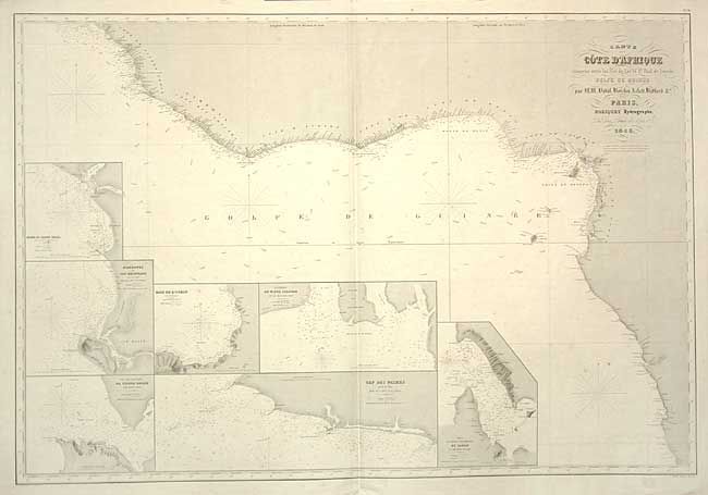
"Carte de la Cote d'Afrique comprise entre les Iles de Los et St. Paul de Loando Golfe of Guinee…", Robiquet, Aime
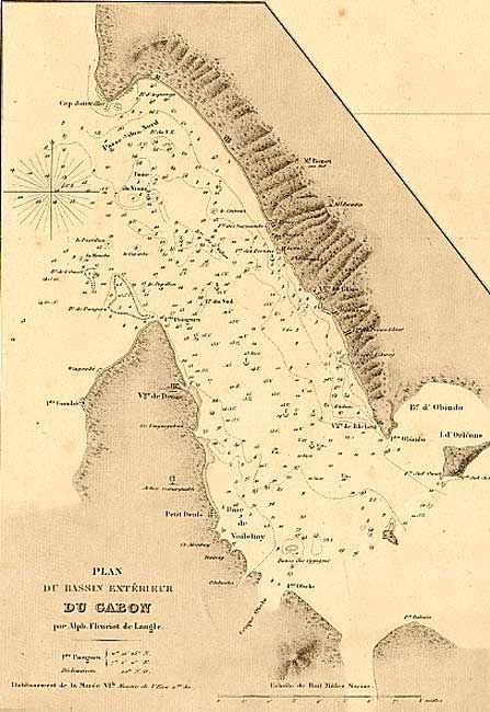
1 of 2
Subject: Africa - Western
Period: 1856 (dated)
Publication:
Color: Black & White
Size:
39 x 26.5 inches
99.1 x 67.3 cm
Download High Resolution Image
(or just click on image to launch the Zoom viewer)
(or just click on image to launch the Zoom viewer)