Catalog Archive
Auction 106, Lot 487

"A Newe Mape of Tartary", Speed, John

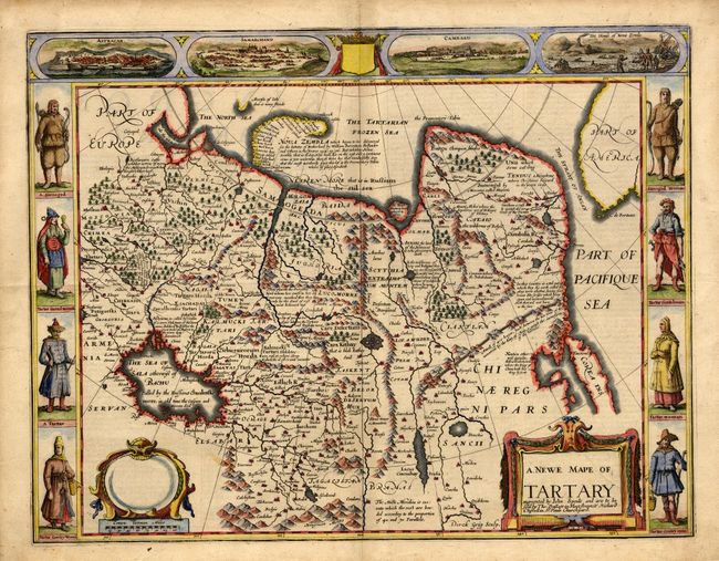
Subject: Asia - Northern

Period: 1676 (circa)

Publication: A Prospect of the Most Famous Parts of the World

Color: Hand Color

Size:
20 x 15.4 inches
50.8 x 39.1 cm
Download High Resolution Image
(or just click on image to launch the Zoom viewer)

Carte-de-figures map covering the region from Lake Baikal through to the regions of present-day Manchuria and Siberia to the north of the Great Wall of China. Korea is shown as an island on the extreme right with parts of North America across the fabled Strait of Anian. The map is fully engraved with mountains and forests, the Great Wall, numerous towns and fascinating notations. Included in the four views at top is a view of Nova Zembla, the winter quarters of Barents, the Dutch explorer who searched for a northern passage between Russia and America. The other views depict important cities of the Silk Route - Astrakan, Samarkand and Cambalu. In the side panels are figures of the people Tartary in their native costume. The English text on verso provides a fascinating and amusing description of the region. Imprint of Bassett and Chiswell.

References:

Condition: A

Lightly toned. Some tears and hinge tape in blank margins.

Estimate: $1,500 - $1,700

Sold for: $1,200

Closed on 3/3/2004

Archived