Catalog Archive
Auction 106, Lot 31

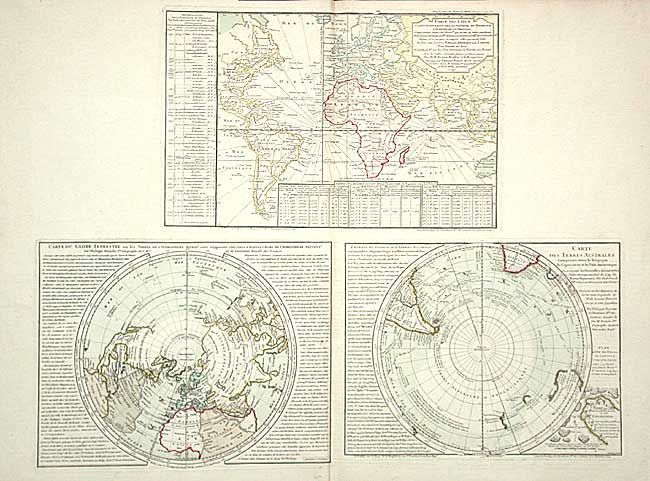
"Carte des Lieux ou les Differentes Longueurs du Pendule… [on sheet with] Carte du Globe Terrestre ou les Terres de l'Hemisphere Meridl. [and] Carte des Terres Australes…", Buache, Philip

Subject: World

Period: 1754-57 (published)

Publication: Cartes et Tables de la Geographie Physique…

Color: Hand Color

Size:
26 x 20 inches
66 x 50.8 cm
Download High Resolution Image
(or just click on image to launch the Zoom viewer)

A very unusual sheet with three separate maps. The map at top is centered on Europe and does not include the western part of North America or the Pacific. It includes tables showing variations in longitude and latitude. The two maps below are polar projections. The Northern Hemisphere is an unusual chart with the continents of the Southern Hemisphere transposed over the map providing a visual depiction of the differences in landmasses. The map of the Southern Hemisphere shows the tracks of recent explorations and includes a "Plan et Vue des Terres du Cap de la Circoncision," an imaginary part of Antarctica.

References:

Condition: A+

Original color.

Estimate: $900 - $1,000

Unsold

Closed on 3/3/2004

Archived