Catalog Archive
Auction 106, Lot 201

"A New Map of the State of Missouri", Thomas, Cowperthwait & Co.
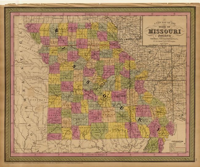
Subject: Missouri

Period: 1853 (published)

Publication: Mitchell's New Universal Atlas

Color: Hand Color

Size:
16.1 x 13.2 inches
40.9 x 33.5 cm
Download High Resolution Image
(or just click on image to launch the Zoom viewer)

A fine county map of the state showing completed surveys throughout, except in the extreme northwest part of the state. Numerous roads are shown together with two completed railroads, colored orange. Several Indian tribes are shown in the adjacent Indian Territory. Dated 1850 but published in 1853.

References:

Condition: B

Even age toning. Tears in margin repaired with archival tape.

Estimate: $80 - $120

Sold for: $75

Closed on 3/3/2004

Archived