Catalog Archive
Auction 106, Lot 163

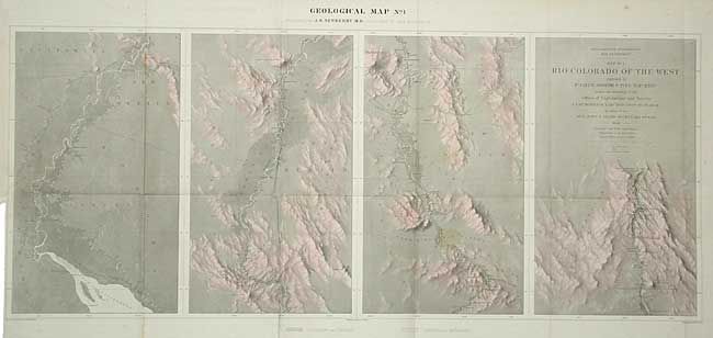
"Map No. 1 Rio Colorado of the West…", Ives, Joseph C. (Lt.)

Subject: United States - Southwestern

Period: 1858 (dated)

Publication: Report upon the Colorado River of the West

Color: Hand Color

Size:
34.7 x 14.5 inches
88.1 x 36.8 cm
Download High Resolution Image
(or just click on image to launch the Zoom viewer)

This map is the first in a series of four that represents one of the most important exploring efforts of the American Southwest. It shows the topography and geology of the lower Colorado river in four panels, beginning at the Gulf and ending in Black Canon at Fortification Rock. Fully and finely engraved with much detail. Light red wash to indicated rock types. Wheat says this is one of the best maps by the remarkable F.W. von Egloffstein and is engraved using his system that imparts the appearance of depth to the topography.

References: Wheat (TMW) #947.

Condition: B

Two very light stains in one panel and a binding side clean tear 2" repaired on verso, else very good.

Estimate: $200 - $250

Sold for: $325

Closed on 3/3/2004

Archived