Catalog Archive
Auction 105, Lot 507

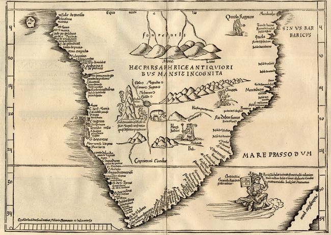
"[Lot of 2] Tab. Mo. Primae Partis Aphricae [together with] Tab. Mo. Secundae Partis Aphricae", Waldseemuller/Fries
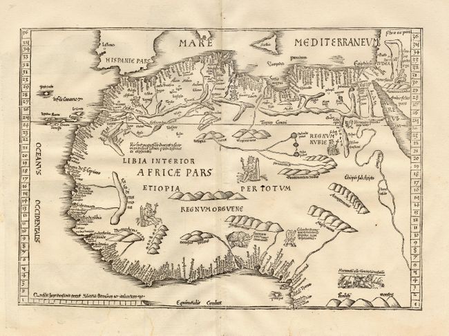
Subject: Africa

Period: 1525 (published)

Publication: Geographia

Color: Black & White

Size:
16.5 x 11.5 inches
41.9 x 29.2 cm
Download High Resolution Image
(or just click on image to launch the Zoom viewer)

Superb matched pair of modern maps by the most learned and influential geographer of the early 16th century. The first map depicts the part of the continent north of the Equator, while the second shows the southern part. Both include a mass of coastal names, primarily from Portuguese sources with the interiors sparsely filled with loaf-like mountains and large rivers. The northern map is ornamented with three kings seated on thrones, fanciful animals and a Colopedes (headless humanoid with an eye in his chest). The southern map shows the Mountains of the Moon as the source of the Nile, three throned kings, an elephant, a cockatrice, and two serpents. In the Mare Prassodum (about where Madagascar should be) the king of Portugal rides a sea creature. The maps were originated by Waldseemuller in 1513 and re-engraved on more embellished plates for the Fries editions. Titles are on verso with charming designs of decorated architectural pillars and vignettes. Size varies slightly.

References: Tooley (AF) W4 & S4.

Condition: A

Fine crisp impressions. Both with small binding holes in blank margins, as is usual. First with two minor damp stains in bottom margin.

Estimate: $3,000 - $3,500

Sold for: $2,200

Closed on 12/3/2003

Archived