Catalog Archive
Auction 105, Lot 490
"China Veteribus Sinarum Regio nunc Incolis Tame dicta", Blaeu, Johannes
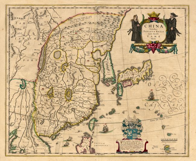
Subject: China, Korea & Japan
Period: 1640 (circa)
Publication:
Color: Hand Color
Size:
19.6 x 16.2 inches
49.8 x 41.1 cm
Download High Resolution Image
(or just click on image to launch the Zoom viewer)
(or just click on image to launch the Zoom viewer)