Catalog Archive
Auction 105, Lot 166

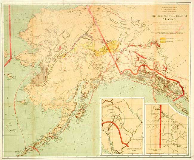
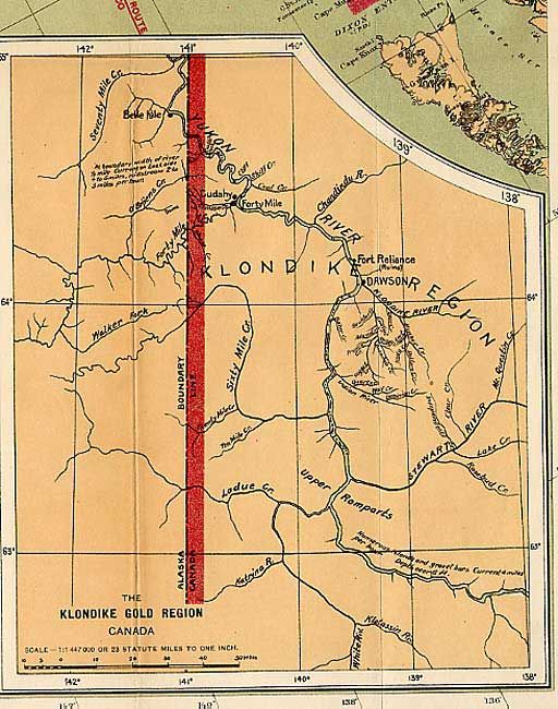
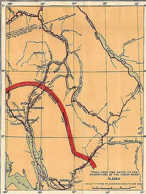
"The Gold and Coal Fields of Alaska Together with the Principal Steamer Routes and Trails", U.S. Geological Survey (USGS)

Subject: Alaska

Period: 1898 (dated)

Publication: U.S. Geological Survey

Color: Printed Color

Size:
28.5 x 23.5 inches
72.4 x 59.7 cm
Download High Resolution Image
(or just click on image to launch the Zoom viewer)

A fine geological map printed by the five-color lithographic method with considerable place name detail. The Birch Creek and Forty Mile gold regions are prominently shown. There are two insets: "Trails from the tide water to the headwaters of the Yukon River, Alaska" and "The Klondike Gold Region, Canada." Monthly steamer routes are shown servicing areas from Norton Sound, along the south side of the Aleutians and along the Alaskan Coast to San Francisco. One of the great maps of the Alaskan Gold Rush.

References: Falk (AK) 1898-51; Phillips (AK) p. 117.

Condition: B

Issued folding, now tissue backed. Some color offsetting and very light toning along a couple folds, otherwise very good.

Estimate: $150 - $200

Sold for: $170

Closed on 12/3/2003

Archived