Catalog Archive
Auction 105, Lot 155

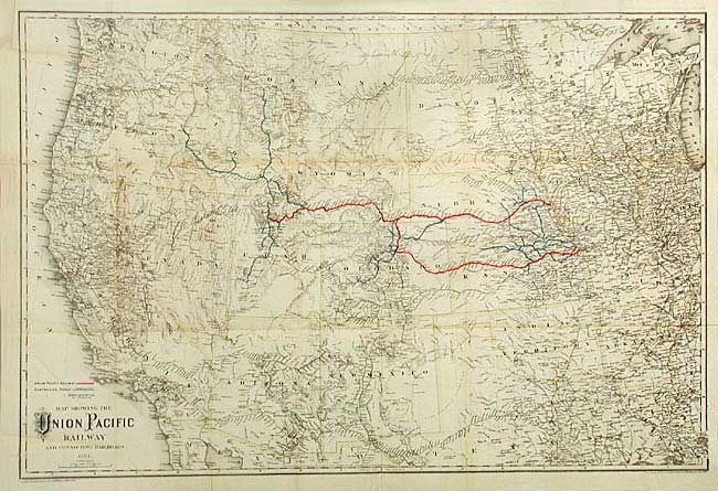
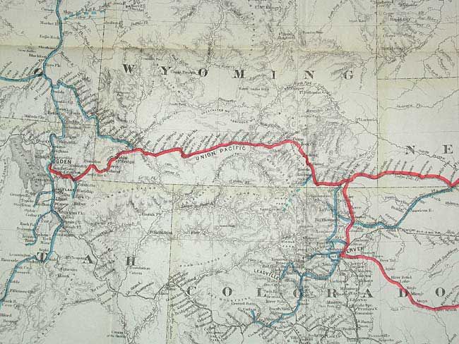
"Map Showing the Union Pacific Railway and Connecting Railroads", Colton, G.W. & C.B.

Subject: Western United States

Period: 1884 (dated)

Publication:

Color: Printed Color

Size:
33 x 22 inches
83.8 x 55.9 cm
Download High Resolution Image
(or just click on image to launch the Zoom viewer)

Uncommon map depicting the Union Pacific Railroad with the completed main lines from Omaha and Kansas City through Ogden colored in red. The ancillary "controlled" roads are shown in blue and proposed roads shown in dotted blue lines. The map is very detailed and covers the region from Michigan and Louisiana westward. Designed by Colton, printed by Rufus Adams and published in a stockholders report. The states are outlined in a faint yellow outline.

References:

Condition: A

Clean and bright. Folding as issued with minor separations at fold intersections.

Estimate: $300 - $350

Sold for: $170

Closed on 12/3/2003

Archived