Catalog Archive
Auction 105, Lot 148

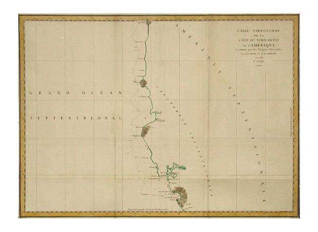
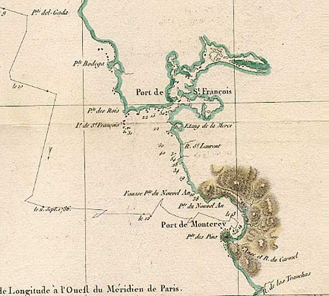
"Carte Particuliere de la Cote du Nord-Ouest de l'Amerique reconnue par les Fregates Francaises la Boussole et l'Astrolabe en 1786. 3e. Feuille", La Perouse, Comte Jean F. Galoup, de

Subject: United States - Western

Period: 1799 (published)

Publication: Atlas du Voyage de la Perouse

Color: Hand Color

Size:
27 x 19.6 inches
68.6 x 49.8 cm
Download High Resolution Image
(or just click on image to launch the Zoom viewer)

Large-scale map of the West Coast from Monterey California to Cap Rond in present-day Oregon depicting the route of the voyage with only those parts actually surveyed. Jean-Francois de Galaup, Comte de La Perouse commanded a French scientific expedition to the Pacific in 1785-88. Recognized as one of the foremost naval commanders and navigators in France, he was selected by King Louis XVI to complete Captain James Cook's exploration of the western Pacific. La Perouse explored the coasts of the Gulf of Alaska and northwestern North America in search of the fabled Northwest Passage. After leaving America his expedition continued on to Asia where he explored from Kamchatka to Macao and the Solomon Islands in the South Pacific. His expedition vanished shortly after leaving Botany Bay, Australia, in 1788.

References: Wagner #845.

Condition: B

Folding and close margins as issued. Small binding tear in border, closed with archival tape.

Estimate: $250 - $300

Unsold

Closed on 12/3/2003

Archived