Catalog Archive
Auction 104, Lot 621

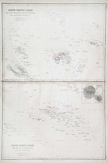
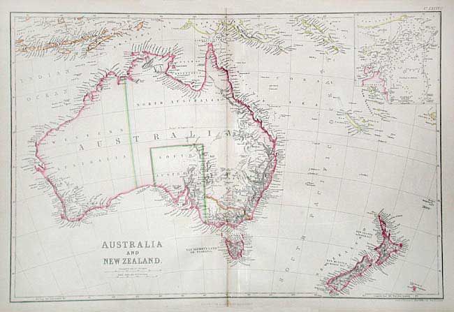
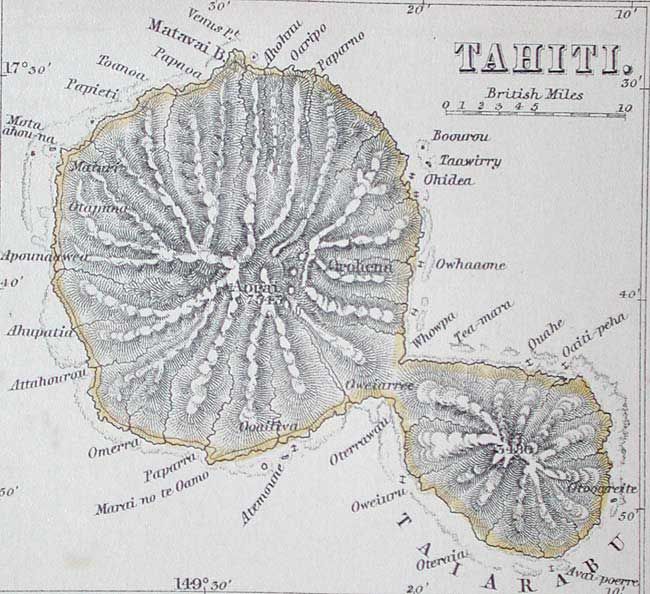
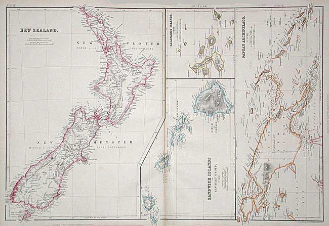
"[Lot of 3] Australia and New Zealand [ with] New Zealand [on sheet with] Sandwich Islands / Galapagos Islands / Papuan Archipelago [and] South Pacific Ocean…", Blackie, W. G. & Son

Subject: Pacific Ocean

Period: 1860 (published)

Publication: The Imperial Atlas

Color: Hand Color

Size:
19.7 x 13.2 inches
50 x 33.5 cm
Download High Resolution Image
(or just click on image to launch the Zoom viewer)

Nice lot of detailed maps. 1) Australia and New Zealand shows Australia with a nearly blank interior and good coastal detail. New Zealand, the southern islands of Indonesia, and the Solomon and New Hebrides Islands are also well mapped. Inset of the Torres Strait. 2) New Zealand / Sandwich Islands / Galapagos Islands / Papuan Archipelago includes four maps, each very finely detailed. 3) South Pacific Ocean - The New Hebrides, Loyalty, Feejee, and Friendly Islands &c. - The Society, Marquesas, and Low Islands &c., this sheet includes two great maps plus an inset of Tahiti.

References:

Condition: B

All with good color and full margins. Faint toning along centerfolds. Couple of very tiny worm holes (nearly invisible) just inside neat line of first map.

Estimate: $120 - $160

Unsold

Closed on 9/10/2003

Archived