Catalog Archive
Auction 104, Lot 50

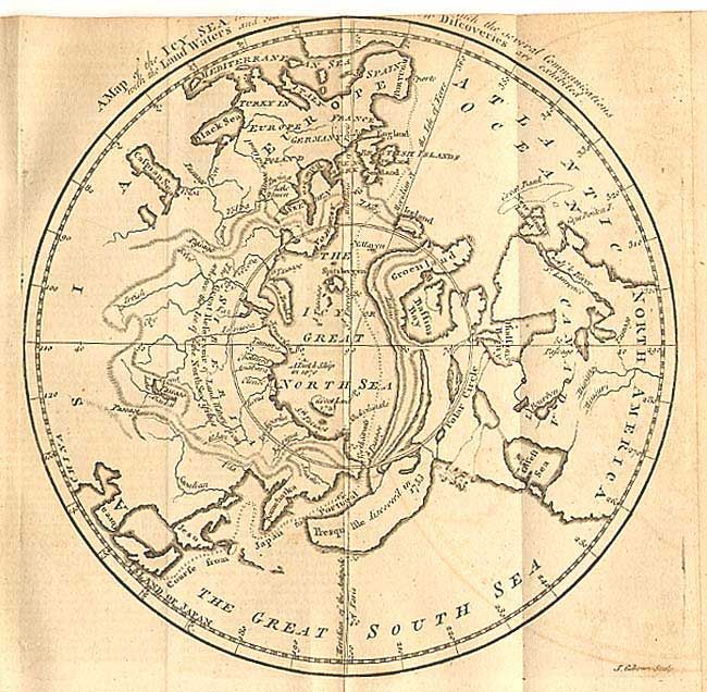
"A Map of the Icy Sea in Which the Several Communications with the Land Waters and Other New Discoveries are Exhibited", Gibson, John

Subject: North Pole

Period: 1760 (published)

Publication: Gentleman's Magazine

Color: Black & White

Size:
7.7 x 7.7 inches
19.6 x 19.6 cm
Download High Resolution Image
(or just click on image to launch the Zoom viewer)

Based on the work of Jean Palairet, this is a very interesting map of the Northern Hemisphere and the Icy Great North Sea surrounding the North Pole. Contrary to custom, Europe is located at left with America on the right. The course of the imaginary Northwest Passage is depicted from Portugal to Japan. Highly distorted landmasses, including a huge single island where the Aleutians are today, noted as being discovered in 1753. Still bound in the original and complete June 1760 issue (48 pp.) with related article.

References: Jolly GENT-141.

Condition: B

Lightly toned with some offsetting. Part of title trimmed off on top edge, as published.

Estimate: $120 - $160

Sold for: $95

Closed on 9/10/2003

Archived