Catalog Archive
Auction 104, Lot 285
"Carta General de las Islas Antillas Menores Llamadas de Barloven to Y Tambien Caribes…", Lopez de Vargas Machuca, Thomas (don)
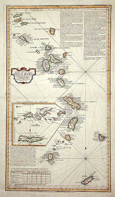
Subject: Lesser Antilles
Period: 1781 (dated)
Publication:
Color: Hand Color
Size:
15.5 x 27.5 inches
39.4 x 69.9 cm
Download High Resolution Image
(or just click on image to launch the Zoom viewer)
(or just click on image to launch the Zoom viewer)