Catalog Archive
Auction 104, Lot 280

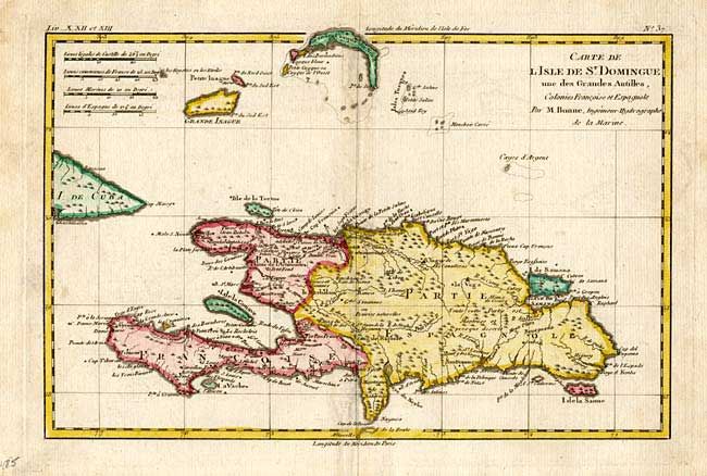
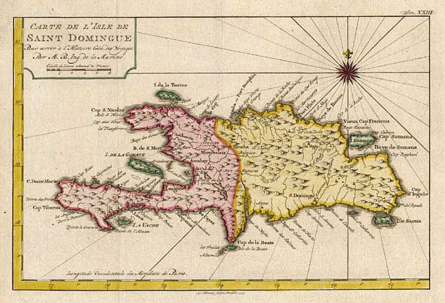
"[Lot of 2] Carte de l'Isle de Saint Domingue [together with] Carte de l'Isle de St. Domingue, une des Grandes Antilles", Various

Subject: Hispaniola

Period: 1760-74 (circa)

Publication:

Color: Hand Color

Size:
See Description
Download High Resolution Image
(or just click on image to launch the Zoom viewer)

Nice pair of French maps of Hispaniola each with good detail. 1 - Carte de l' Isle de Saint Domingue, by J.N. Bellin and engraved by A. van Krevelt for a Dutch edition of Prevost's Voyages, Amsterdam, 1775 (11.2 x 7.5"). 2 - Carte de l Isle de St. Domingue, une des Grandes Antilles by R. Bonne, Paris, circa 1774 (12.4 x 8.2"). This map also includes the Caicos and Turks Islands. Together they provide an interesting comparison both in topography, place names and the political boundaries between the French and Spanish colonies.

References:

Condition: A

First fine, second with faint soil on fold.

Estimate: $220 - $275

Sold for: $160

Closed on 9/10/2003

Archived