Catalog Archive
Auction 104, Lot 257

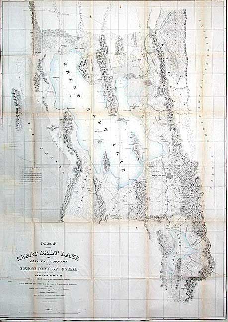
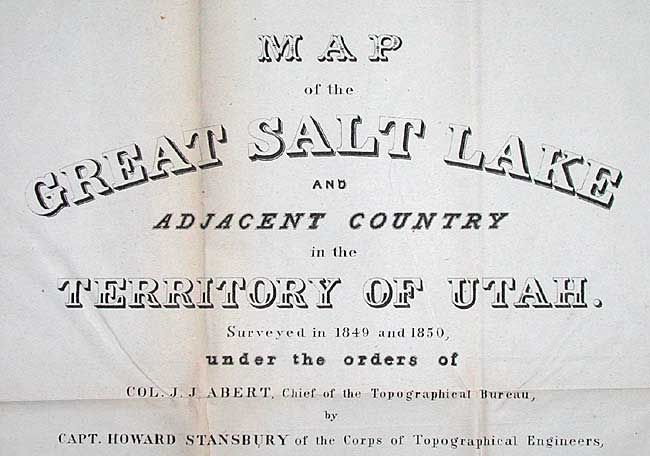
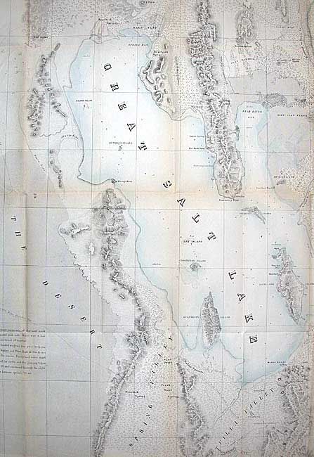
"Map of the Great Salt Lake and Adjacent Country in the Territory of Utah", Stansbury, M. Howard (Capt.)

Subject: Utah

Period: 1852 (circa)

Publication: An Expedition to the Valley of the Great Salt Lake of Utah…

Color: Hand Color

Size:
29.9 x 42.5 inches
75.9 x 108 cm
Download High Resolution Image
(or just click on image to launch the Zoom viewer)

Stansbury's important exploration of the Great Salt Lake Basin with this important map permanently established the topography and many of the place names of northwestern Utah. It extends from the 42nd parallel and includes the Wastch Mountains, Cache Valley and Ogdens Hole and south to include Lake Utah and the Youab Valley. Indian, as well as Mormon, names are given for the creeks. A great notation in The Desert west of the lake provides important information for travelers, "This desert consists of clay and sand impregnated with salt. When wet, it has the consistency of mortar. Lightly loaded wagons can pass between Spring Valley and Pilot Peak in the driest part of the season. Forage and water must be carried for cattle, and the journey begun in the P. M. and continued through the night. Distance between springs 70 ms." Lithographed by Ackerman.

References: Wagner-Camp #219:1; Wheat [TMW] #765.

Condition: B

Original light wash color in lakes. Folding as issued with minor toning at folds. Trimmed into neatline at binding side. Couple of very tiny separations at fold intersections. Overall very good for a map of this size.

Estimate: $375 - $450

Sold for: $200

Closed on 9/10/2003

Archived