Catalog Archive
Auction 104, Lot 231

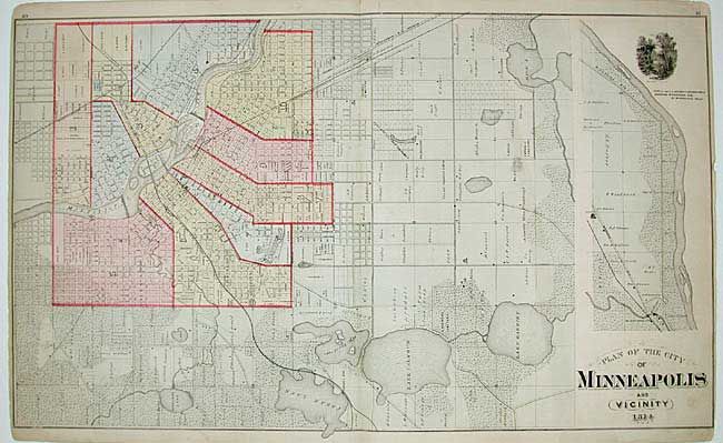
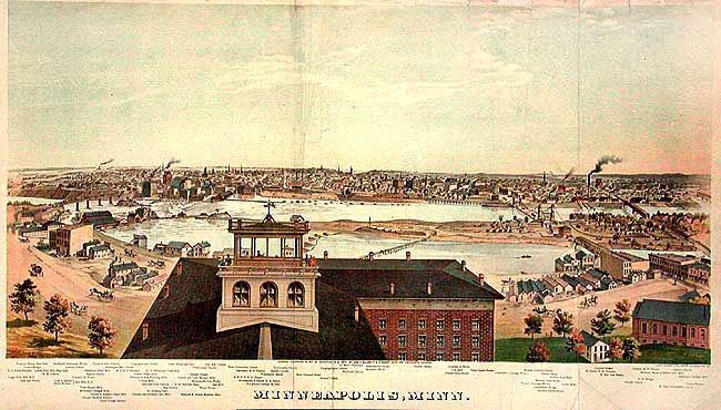
"[Lot of 2] Plan of the city of Minneapolis and Vicinity [and] Minneapolis, Minn.", Andreas, Alfred T.

Subject: Minnesota

Period: 1874 (published)

Publication: Illustrated Historical Atlas of the State of Minnesota

Color: Printed Color

Size:
See Description
Download High Resolution Image
(or just click on image to launch the Zoom viewer)

A fine set of city plan (27.5 x 16.2") and superb panorama of the city (29.5 X 14.8") by George Ellsbury and Vernon Green. The detailed city plan extends into the surrounding countryside and includes a vignette of Minnehaha Falls. The panorama, with names of the prominent buildings below, is one of three large chromolithograph views from this remarkable atlas. The view shows Minneapolis from the east bank of the Mississippi, with the St. Anthony Falls and its flourmills at the left and the commercial and residential districts of the city in the center and right. A.T. Andreas' atlas was sold by subscription to prominent landowners throughout the state. He chose Minnesota because the state was young, the population was affluent, and the eastern mapmakers had not yet worked the area. He brought together the production facilities in Chicago, canvassers to sell subscriptions, surveyors to create plat maps, writers to produce the written materials, and artists to draw illustrations of cities, farms and portraits. The result was a comprehensive and intimate portrait of the state and is a wealth of historical information today. Maps of Hennepin and Ramsey Counties are on the verso of the plan.

References: Phillips (A) #2007; Ristow, pp. 433-439.

Condition: B

Map with a few minor marginal tears. View with some paper replaced in top blank margin and several professional repairs on folds and minor tears.

Estimate: $750 - $1,000

Sold for: $375

Closed on 9/10/2003

Archived