Catalog Archive
Auction 104, Lot 226

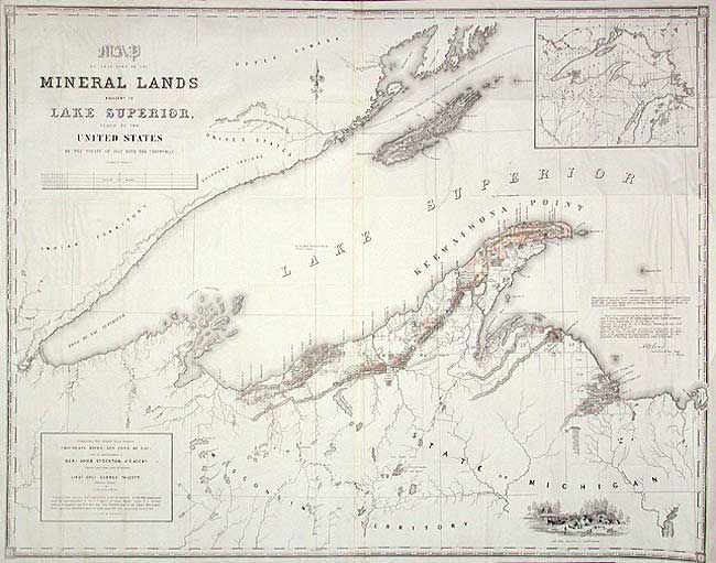
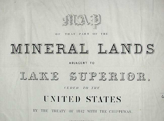
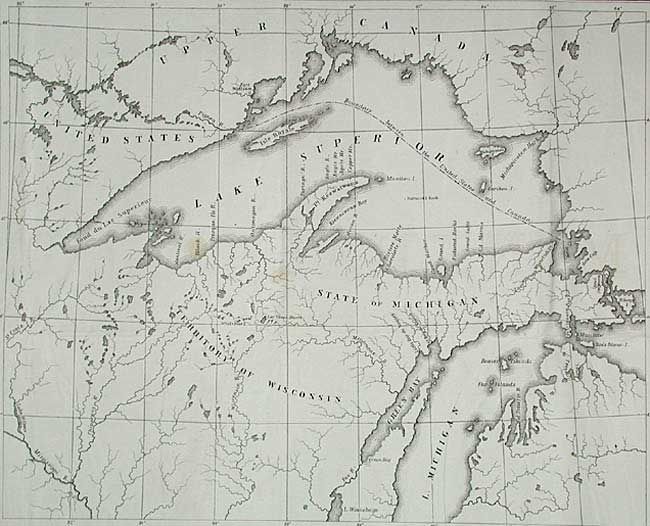
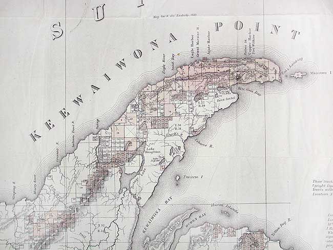
"Map of that part of the Mineral Lands adjacent to Lake Superior ceded to the United States by the Treaty of 1842 with the Chippewas", U.S. Government

Subject: Michigan

Period: 1845 (dated)

Publication: Serial 461, Sen. Doc 175. 28th Cong. 2nd Sess..

Color: Hand Color

Size:
44.8 x 35.8 inches
113.8 x 90.9 cm
Download High Resolution Image
(or just click on image to launch the Zoom viewer)

Subtitled: "Comprising that District between Chocolate River and Fond du Lac under the superintendence of Gen. John Stockton, U.S. Agent." This uncommon map was compiled partly from explorations made in 1844 by the Mineral Lands Agency at Copper Harbor, partly from a map published by S.D.U.K. and drawings from U.S. Surveys by Dr. Houghton, W.A. Burt, Nicollet & Bayfield. Mineral tracts are located and numbered, with leased tracts indicated by hand coloring. It shows the trap range of northern Michigan, locations of the American Fur Company Posts and Catholic/Methodist Missions. Large inset map of Lake Superior, and engraved view of Camp Gray near Talcott Harbor.

References:

Condition: A

On two sheets, joined. Issued folding, now backed by archival tissue. Trace of toning on some folds, remarkable condition for a map of this size and age.

Estimate: $200 - $250

Sold for: $210

Closed on 9/10/2003

Archived