Catalog Archive
Auction 104, Lot 198

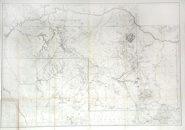
"[Map of the Navajo Reservation, Arizona and New Mexico]", U.S. Government

Subject: United States - Southwestern

Period: 1893 (circa)

Publication: Senate Doc #68, 52nd Cong., 2nd Sess.

Color: Black & White

Size:
49.5 x 33.7 inches
125.7 x 85.6 cm
Download High Resolution Image
(or just click on image to launch the Zoom viewer)

A detailed map of the Navajo Indian Reservation in northeastern Arizona and northwestern New Mexico. Shows location of irrigation ditches, springs, wells, creeks, rivers, canyons, valleys, mountains, mesas, villages, lakes and passes. Contour intervals at 1000 feet. Also depicts the routes of exploration of Lt. Brown, Lt. Suplee and Lt. Gurovits during their water supply investigations in 1892. Locates Monument Valley, Hopi Mesas, Ft. Defiance and much more. With a Notation of Executive Order that takes away part of the Navaho Reservation in Utah.

References:

Condition: B

Backed with archival tissue. Most of the map is very good, but the lower left area has toning, closed splits and small loss at one fold intersection.

Estimate: $250 - $300

Unsold

Closed on 9/10/2003

Archived