Catalog Archive
Auction 104, Lot 194

"Colton's Territories of New Mexico and Utah", Colton, Joseph Hutchins

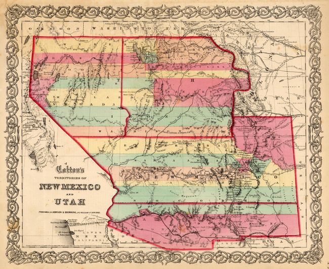
Subject: United States - Southwest

Period: 1859 (published)

Publication:

Color: Hand Color

Size:
15.7 x 13 inches
39.9 x 33 cm
Download High Resolution Image
(or just click on image to launch the Zoom viewer)

This is a very scarce issue of this great map of the American Southwest. Both the territories of Utah and New Mexico are shown in a transitional state with boundaries of proposed new territories. The proposed territory of Arizona is shown to the south of New Mexico. The newly proposed territory of Nevada is shown taking in the western part of Utah with the border at the 114th meridian, but wandering south-south-west from Preuss L. to form a boundary along the Spanish Trail. To the east of Utah is yet another provisional territory, that of Colona, which became Colorado in 1861. The map locates numerous early exploration routes, mail routes and proposed routes for the Pacific Railroad, and much more. Surrounded by Colton's distinctive scroll border. Dated 1855, but published by Johnson & Browning in 1859.

References:

Condition: A

A few minor spots, still overall very good.

Estimate: $700 - $900

Sold for: $950

Closed on 9/10/2003

Archived