Catalog Archive
Auction 104, Lot 174

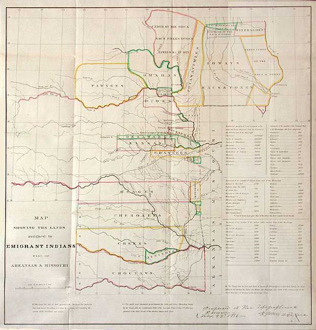
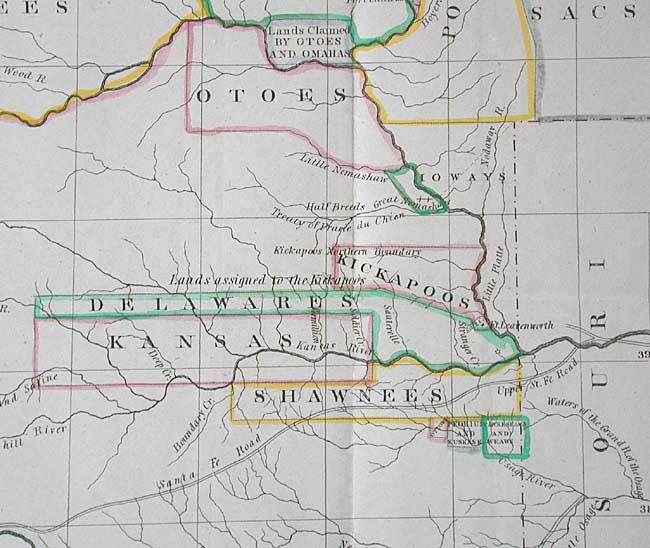
"Map Showing the Lands Assigned to Emigrant Indians West of Arkansas & Missouri", U.S. War Dept.

Subject: United States - Central

Period: 1836 (published)

Publication: Report of the Dragoons under command of Colonel Henry Dodge

Color: Hand Color

Size:
17.7 x 18.5 inches
45 x 47 cm
Download High Resolution Image
(or just click on image to launch the Zoom viewer)

The map covers the region of present day Iowa, Nebraska, Kansas and Oklahoma. The tribal lands are outlined in color. An inset provides tabulations of the numbers of Indians and a listing of estimated acres of land assigned to these Tribes. While it shows the Santa Fe Road, the route of Col. Dodge is not depicted. The map is based on the 1835 map prepared by Lt. Washington Hood and Wheat calls it "an important historical map." This is the original issue, not to be confused with the later issue by the ASP Military Affairs.

References: Claussen & Friis #127; Wagner-Camp #63; Wheat [TMW] #412.

Condition: A+

Fine example with original color and good margins all around. Slight soil in right margin, still fine. Folding, as issued.

Estimate: $375 - $450

Sold for: $350

Closed on 9/10/2003

Archived