Catalog Archive
Auction 104, Lot 166

"States of America, Drawn from the Best Authorities", Russell, John C.
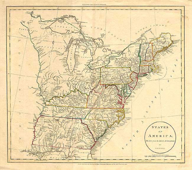
Subject: United States - Eastern

Period: 1811 (dated)

Publication:

Color: Hand Color

Size:
17.5 x 15.5 inches
44.5 x 39.4 cm
Download High Resolution Image
(or just click on image to launch the Zoom viewer)

A handsome and fascinating map detailing states and Indian lands east of the Mississippi River from northern Florida to Canada. Tracts of land in west of the Ohio River are labeled Seven Ranges, Army Lands, Ohio Company, and Donation Lands from the Commonwealth of Virginia, Illinois Company, Wabash Company, New Jersey Company and Col. Simmes. South of the Ohio River, in present-day West Virginia, is a small region named Indiana. The Twenty Leagues Line is drawn in the coastal Atlantic. Georgia's western boundary is the Mississippi River. Various Indian tribes are indicated throughout.

References:

Condition: B

Faint toning along centerfold with a couple of tiny spots in map. Small tears in bottom blank margin, closed with archival tape on verso, else very good.

Estimate: $300 - $400

Sold for: $220

Closed on 9/10/2003

Archived