Catalog Archive
Auction 104, Lot 153

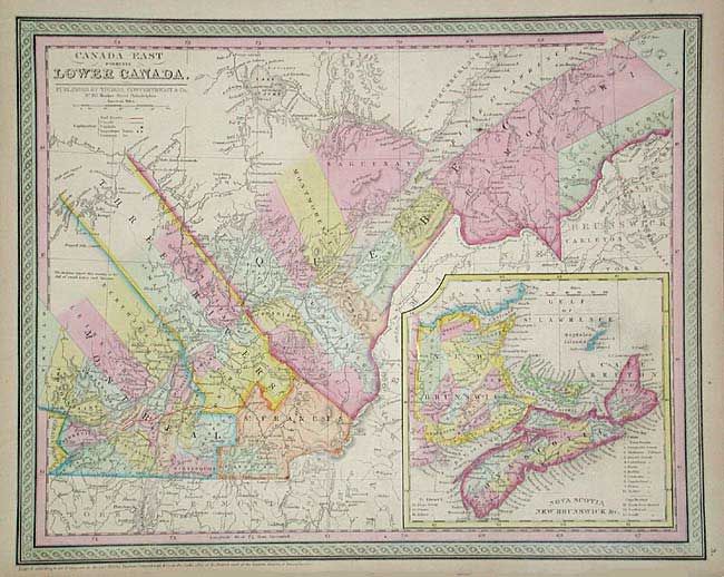
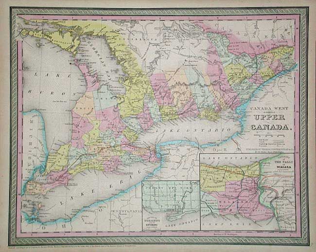
"[Lot of 2] Canada West formerly Upper Canada [together with] Canada East formerly Lower Canada", Thomas, Cowperthwait & Co.

Subject: Canada

Period: 1853 (published)

Publication: Mitchell's New Universal Atlas

Color: Hand Color

Size:
15.5 x 12.5 inches
39.4 x 31.8 cm
Download High Resolution Image
(or just click on image to launch the Zoom viewer)

Matched pair of nicely engraved maps of Canada. First chart is centered on Toronto and shows all of Lake Erie and Lake Ontario. Extends east to beyond Cornwall on the St. Lawrence. Insets of the City of Toronto and another of the vicinity of the Falls of Niagara. Second shows good detail along the St. Lawrence centered on Quebec. Large inset of the Maritime Provinces. Both surrounded by attractive borders.

References:

Condition: A

Estimate: $150 - $200

Sold for: $110

Closed on 9/10/2003

Archived