Catalog Archive
Auction 104, Lot 141
"A New & Accurate Map of Louisiana, with Part of Florida and Canada, and the Adjacent Countries Drawn from Surveys, assisted by the most approved English & French Maps & Charts", Bowen, Emanuel
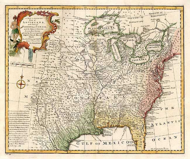
Subject: Colonial Louisiana
Period: 1757 (published)
Publication: A Complete System of Geography
Color: Hand Color
Size:
16.5 x 13.5 inches
41.9 x 34.3 cm
Download High Resolution Image
(or just click on image to launch the Zoom viewer)
(or just click on image to launch the Zoom viewer)