Catalog Archive
Auction 103, Lot 96

"Karte von Carolina und Georgien", Bellin, Jacques Nicolas

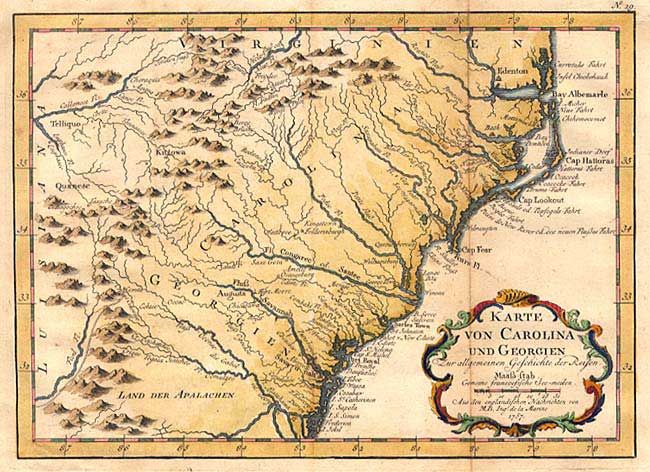
Subject: Colonial Southeast

Period: 1757 (circa)

Publication: Allgemeine Historie der Reisen zu Wasser und zu Lande

Color: Hand Color

Size:
10 x 7.3 inches
25.4 x 18.5 cm
Download High Resolution Image
(or just click on image to launch the Zoom viewer)

Delicately engraved map of the colonies from Albemarle Sound to the Alatamaha River. It probably owes its origin to the 1752 map of the region by Emanuel Bowen. Numerous English settlements along the coast and Indian villages throughout, including a number west of the Appalachian Mountains. There is more detail in the area west of the Blue Ridge than in many other maps of the period. Embellished with a decorative title cartouche.

References: Sellers & van Ee # 1385.

Condition: B

Slight toning along fold with light, scattered foxing in margins.

Estimate: $350 - $400

Sold for: $325

Closed on 6/11/2003

Archived