Catalog Archive
Auction 103, Lot 85

"A Map of New France containing Canada, Louisiana &c. in Nth. America…", Moll, Herman

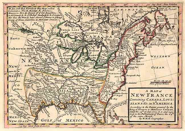
Subject: Colonial United States and Canada

Period: 1730 (circa)

Publication:

Color: Hand Color

Size:
10.2 x 7.4 inches
25.9 x 18.8 cm
Download High Resolution Image
(or just click on image to launch the Zoom viewer)

Interesting map depicting the European possessions in the eastern part of North America. France controls Canada and the Great Lakes region, the British colonies stretch from Carolina to Newfoundland, and Spain controls New Mexico, Louisiana and Florida. Filled with Indian place names and forts.

References: McCorkle #717-1.

Condition: A

Fine crisp impression and attractive color. Faint mat burn in wide margins. Some expert paper restoration including reattaching top two corners, one affecting left border now only visible when held to strong light.

Estimate: $450 - $500

Sold for: $425

Closed on 6/11/2003

Archived