Catalog Archive
Auction 103, Lot 657
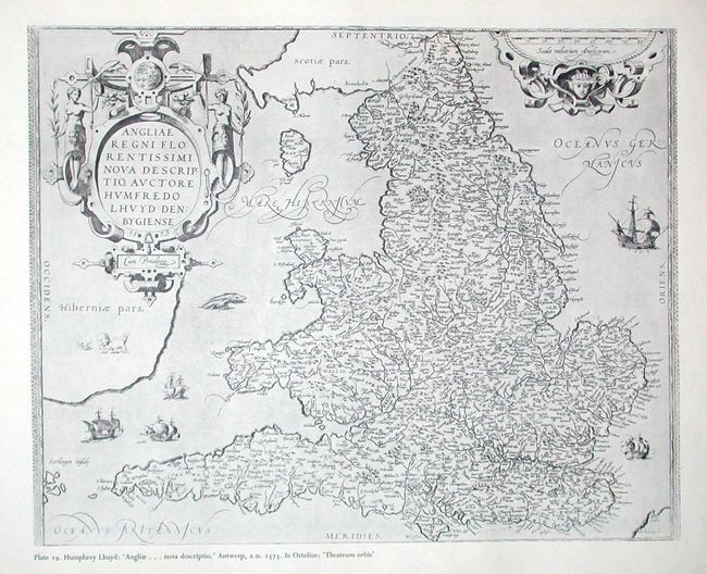
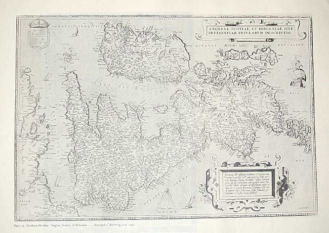
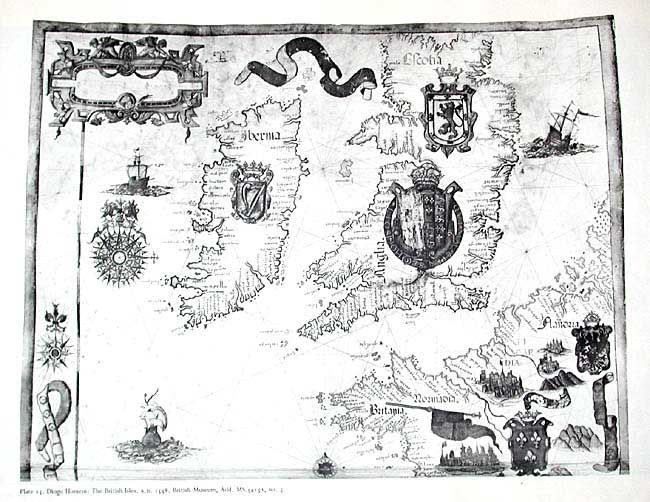
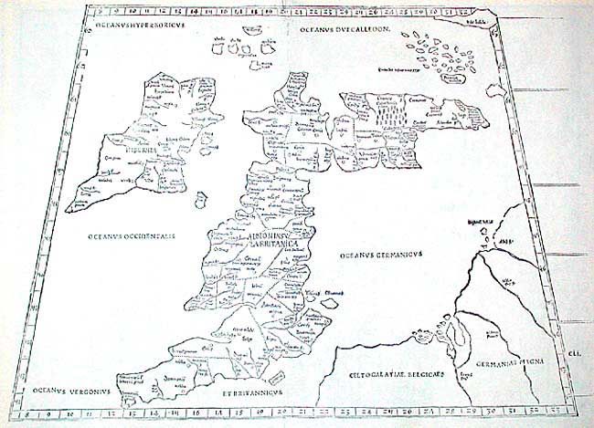
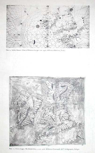
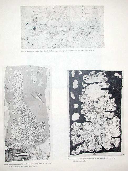
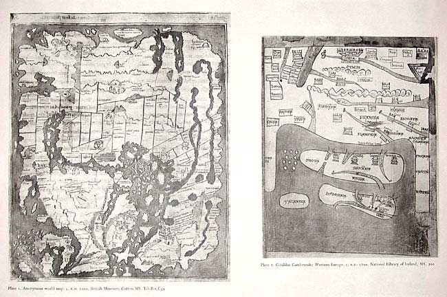
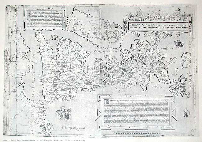
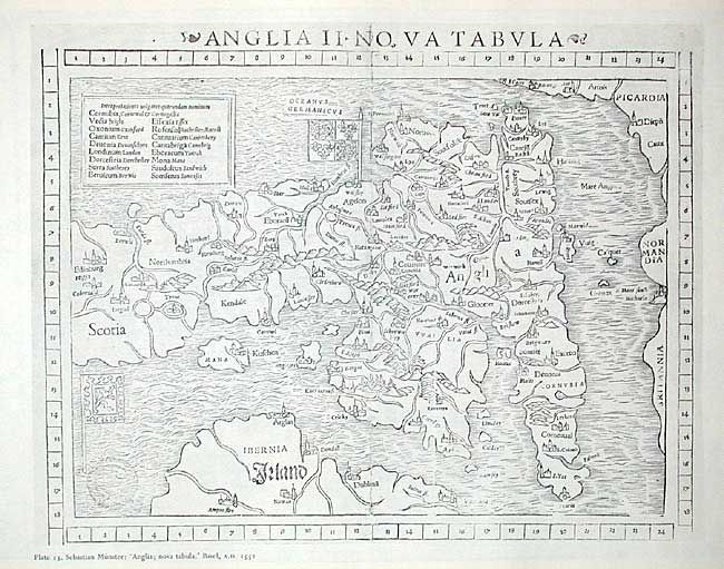
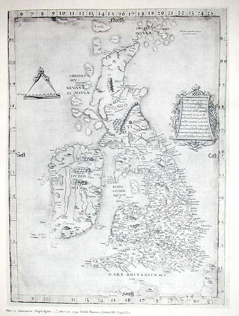
"Early Maps of the British Isles A.D. 1000 - A.D. 1579", Crone, G. R.
1 of 11
Subject: Cartographic Reference
Period: 1961 (published)
Publication: Royal Geographical Society
Color: Black & White
Size:
21.5 x 16.5 inches
54.6 x 41.9 cm
Download High Resolution Image
(or just click on image to launch the Zoom viewer)
(or just click on image to launch the Zoom viewer)