Catalog Archive
Auction 103, Lot 452

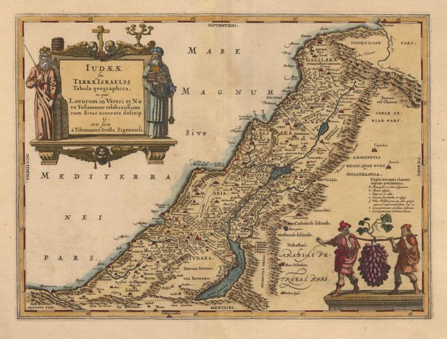
"Iudaeae seu Terrae Israelis Tabula Geographica; in qua Locorum in Veteri et Novo Testamento Celebratissimorum Situs Accurate Descripti", Jansson, Jan
Subject: Holy Land

Period: 1666 (circa)

Publication: Accuratissima Orbis Antiqui Delineatio

Color: Hand Color

Size:
19.2 x 14 inches
48.8 x 35.6 cm
Download High Resolution Image
(or just click on image to launch the Zoom viewer)

Truly stunning map of the Holy Land with gorgeous decoration and fine detail. Map is taken from the one drawn by Tilleman Stella for Ortelius in 1584 for the Typus Chorographicus. It maps the region from Phoenicia south to Petra, detailing the divisions of Galilee, Samaria and Judea. The decorative title cartouche is flanked by portraits of Moses and Aaron, and is supported and topped by putti. The lower right is filled with a vignette of two men carrying a bunch of grapes as large as they are.

References: van der Krogt (Atlantes) 8155:1.

Condition: B

Light toning along centerfold. Lower corners are cut off in blank margins with some worming at lower corner margin. Two old repairs on tear along centerfold in blank margins. Nice old color and beautiful impression on thick paper with wide margins.

Estimate: $800 - $1,000

Sold for: $700

Closed on 6/11/2003

Archived