Catalog Archive
Auction 103, Lot 449

"A New Map of Turkey in Asia Divided into its Provinces, from the Best Authorities", Cary, John

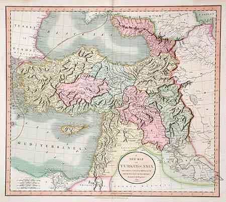
Subject: Near and Middle East

Period: 1801 (dated)

Publication: New Universal Atlas

Color: Hand Color

Size:
21 x 18.2 inches
53.3 x 46.2 cm
Download High Resolution Image
(or just click on image to launch the Zoom viewer)

Covers the region around the eastern coast of the Black Sea, down to Armenia, Kurdistan, Syria, and the Holy Land. The eastern edge of the Mediterranean Sea is shown with a well-detailed Cyprus and extending to the mouth of the Nile River. Much information with towns, topography and caravan routes.

References:

Condition: B

Some marginal flaws and light toning along centerfold, otherwise very good.

Estimate: $250 - $300

Unsold

Closed on 6/11/2003

Archived