Catalog Archive
Auction 103, Lot 228
"Carta Esferica que comprehende los desemboques Al Norte de la Isla de Sto. Domingo y la parte Oriental del Canal Viejo de Bahama...", Direccion de Hidrografia
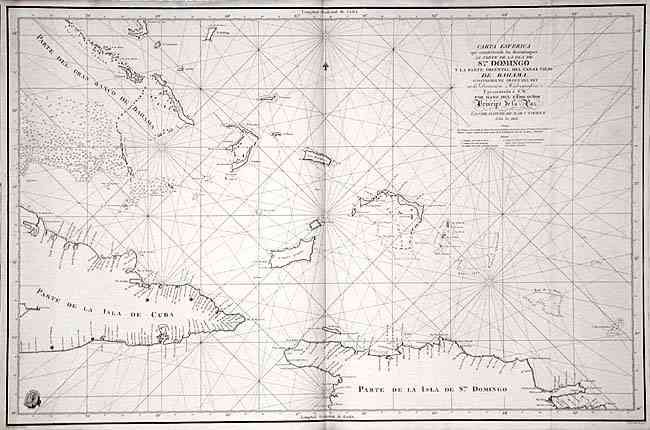
Subject: Greater Antilles
Period: 1802 (dated)
Publication: Atlas maritimo espanol…
Color: Black & White
Size:
35.2 x 22.9 inches
89.4 x 58.2 cm
Download High Resolution Image
(or just click on image to launch the Zoom viewer)
(or just click on image to launch the Zoom viewer)