Catalog Archive
Auction 103, Lot 226

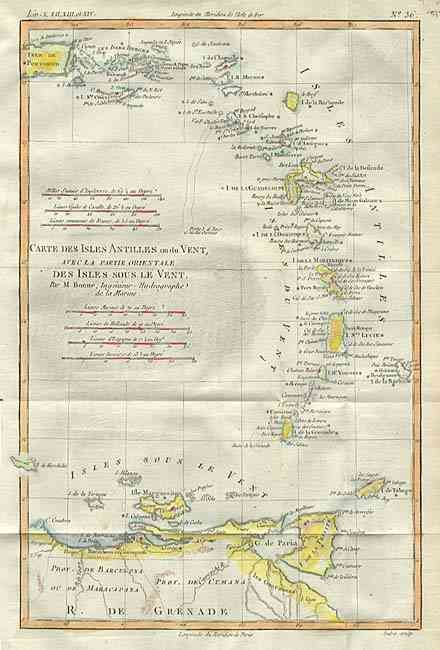
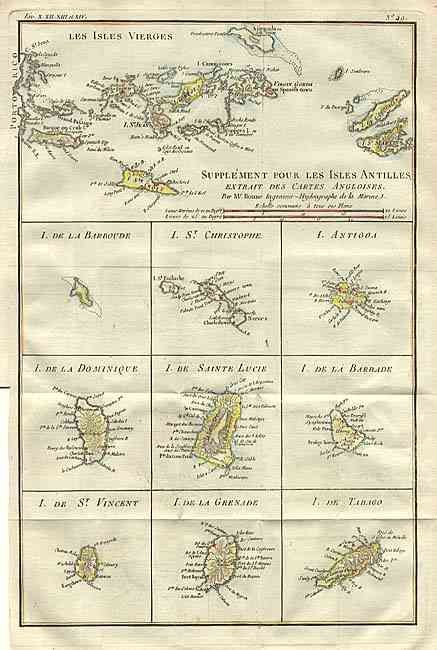
"[Pair] Supplement pour les Isles Antilles, extrait des Cartes Angloises [together with] Carte des Isles Antilles ou du Vent, avec la Partie Orientale des Isles sous le Vent", Bonne, Rigobert

Subject: Lesser Antilles

Period: 1779 (circa)

Publication: Atlas de toutes les parties connues du globe terrestre

Color: Hand Color

Size:
8.5 x 12.5 inches
21.6 x 31.8 cm
Download High Resolution Image
(or just click on image to launch the Zoom viewer)

Nice pair of copper engraved maps of the Antilles. Supplement pour les Isles Antilles, extrait des Cartes Angloises is a map of the Virgin Islands at the top with nine inset maps of the Windward islands including Barbados, Dominica, St. Lucia, Grenada, St. Vincent, Tobago, etc. Carte des Isles Antilles ou du Vent, avec la Partie Orientale des Isles sous le Vent depicts most of the Lesser Antilles, including the Windward and Leeward Islands from Puerto Rico to the northern coast of South America.

References:

Condition: A

Folds as issued. Recent color.

Estimate: $200 - $250

Sold for: $350

Closed on 6/11/2003

Archived