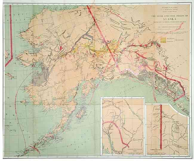
"The Gold and Coal Fields of Alaska Together with the Principal Steamer Routes and Trails", U.S. Geological Survey (USGS)
Subject: Alaska
Period: 1898 (dated)
Publication: U.S. Geological Survey
Color: Printed Color
Size:
28.5 x 23.5 inches
72.4 x 59.7 cm
A fine geological map printed by the five-color lithographic method with considerable place name detail. The Birch Creek and Forty Mile gold regions are prominently shown. There are two insets: "Trails from the tide water to the headwaters of the Yukon River, Alaska" and "The Klondike Gold Region, Canada." Monthly steamer routes are shown servicing areas from Norton Sound, along the south side of the Aleutians and along the Alaskan Coast to San Francisco. One of the great maps of the Alaskan Gold Rush.
References: Falk (AK) 1898-51; Phillips (AK) p. 117.
Condition: A
Issued folding, now tissue backed. Very light toning along two folds, still very good.