Catalog Archive
Auction 103, Lot 144

"Chart of the North West Coast of America Explored by the Boussole & Astrolabe in 1786. 3rd Sheet.", La Perouse, Comte Jean F. Galoup, de

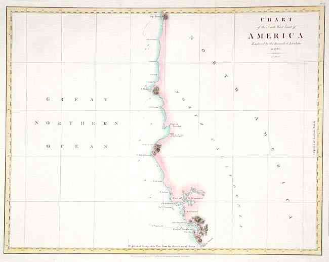
Subject: United States - Pacific Coast

Period: 1799 (published)

Publication: Voyages of La Perouse…

Color: Hand Color

Size:
19.2 x 15 inches
48.8 x 38.1 cm
Download High Resolution Image
(or just click on image to launch the Zoom viewer)

From the Port of Monterey north to Cape Rond (possibly Tillamook Head). Includes the Port of San Francisco. Good detail along coast including Point Bodega, the Capes of Mendocino, Blanco, and Foul-weather, Port of Trinidad, and Punta Gorda. Details the ship's course by numbered days, soundings, rocks and islands. From the English edition, published just two years after the French edition.

References: Phillips (A) 693; Wagner #847.

Condition: A

Good impression on sound paper.

Estimate: $300 - $350

Sold for: $275

Closed on 6/11/2003

Archived