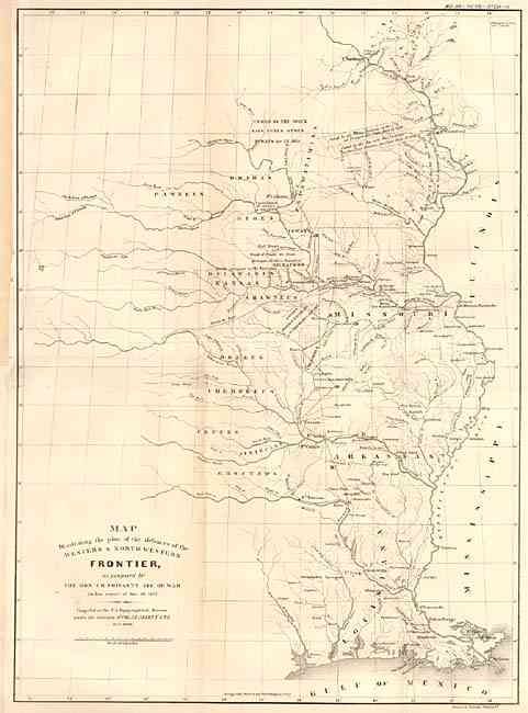
"Map Illustrating the plan of the defences of the Western & North-Western Frontier, as proposed by the Hon: J.R. Poinsett, Sec. of War, in his report of Dec. 30, 1837", Poinsett, J. R.
Subject: Central United States
Period: 1860 (published)
Publication: Military Affairs Vol. VII, No. 753-A
Color: Black & White
Size:
15.5 x 21.5 inches
39.4 x 54.6 cm
This map was originally issued as part of the continuing debate over the nature of the Frontier Defenses between the Mississippi River and the Rocky mountains in J.R. Poinsett, Secretary of War, report of 1837. It illustrates the state of Missouri, Arkansas and Louisiana and the Indian nations bordering them to the west. Locates many military forts and outposts from Ft. Jessup to Ft. Snelling with notations throughout concerning the regions ceded by several Indian nations with the dates of the treaties. Later color with full wash in states and outline color depicting the various Indian tribes.
References: cf Wheat [TMW] #426.
Condition: A
Backed with tissue. Close trimmed at binder's side and remargined for support, away from map.